Fox6, multirotor drone for accurate topography
Secure surveying and high precision measurements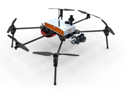
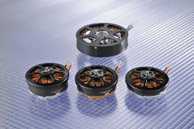
Description
Its solid structure and in-flight stability allows its use on a wide variety of sites. Fully automatic, the Fox6 can carry out photogrammetry missions of up to 1.5 km². It is the perfect tool for large scale mapping missions as well as for static work and volume measurements. Thanks to its HD sensor and compatibility with DroneBox RTK, the Fox6 provides high precision for georeferenced photo collages, orthophotos, point clouds and DTMs / DSMs. This drone is made for professionals of the measurement such as surveyors, topographers, archaeologists and responsible for quarries or mines.
- Surveying equipment
- Drone
- Surveying equipment
- photogrammetry
Product characteristics
- Autonomy
- Up to 25 Min
- Scan surface
- Up to 50 ha (123 acres)
- Max takeoff weight
- 7.5 kg
Documents
Videos
Similar products
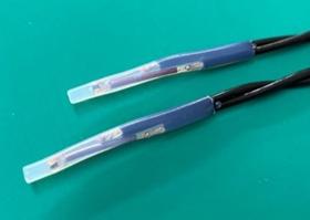
TATEYAMA KAGAKU CO., LTD.
Japan

We have newly developed an thermistor sensor for Automotive. This is suitable for measurement of EV and HEV motors and batteries temp. It has begun to be widely adopted by Japanese automobile manufacturers. It can also be used for various other purposes. Please contact the following for details. E-mail sensor@tateyama.or.jp
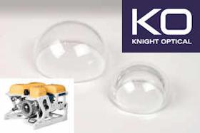
KNIGHT OPTICAL (UK) LTD
United Kingdom
Knight Optical has successfully launched a range of Stock Optical Domes for protective housing for Drone and Vision system cameras, where protection of electronic sensor systems and expensive fish-eye lenses from harsh liquid and gas environments is essential. A dome is essentially a window that has two parallel curves faces. Our domes are high quality with good form error polished faces to ensure high clarity and transmission in the Visible and NIR spectrums allowing for accurate measurement. Capabilities: Domes are readily mountable, optically clear and manufactured to a high standard. Available from 5mm to 200mm in diameter and 0.25 to 10mm in thickness offering high transmission and extreme toughness for harsh environments. For more details read the PDF ...
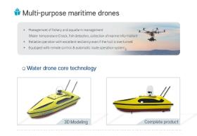
EC PLAZA
South Korea
Description - Development of drones with unmanned remote range capable of coastal surveying, and the construction of control system capable of interworking and controlling survey information - Water Drone with Marine Remains and Sea Oil Film Treatment - Equipped with core technologies needed for maritime management, allowing for a variety of measurement and management tasks with only operation of developed drones to minimize waste of time and resources. Features · Real-time observation of weather, maritime and physical data using ultrasound radar, observation sensors. · Maritime drones for coastal observation and securing of water resources. · Life saving is possible in the event of a maritime accident. · Precise and stable surveying specialized drone · Remotely adjustable and self-driving · The small ship type capable of when necessary boarding · Mobile control system construction · Various addition function mount
Request for quotes
Create one request and get multiple quotes form verified suppliers.
- Only relevant suppliers
- Data privacy compliant
- 100% free